
Dosya:Somerset UK relief location map.jpg

Bu önizlemenin boyutu: 800 × 505 piksel. Diğer çözünürlükler: 320 × 202 piksel | 640 × 404 piksel | 1.024 × 647 piksel | 1.280 × 808 piksel | 2.019 × 1.275 piksel.
Tam çözünürlük ((2.019 × 1.275 piksel, dosya boyutu: 367 KB, MIME tipi: image/jpeg))
Bu dosya Wikimedia Commons'ta bulunmaktadır. Dosyanın açıklaması aşağıda gösterilmiştir. Commons, serbest/özgür telifli medya dosyalarının bulundurulduğu depodur. Siz de yardım edebilirsiniz. |
| Açıklama |
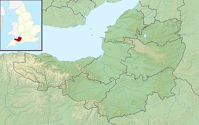
Relief map of Somerset, UK. Equirectangular map projection on WGS 84 datum, with N/S stretched 155% Geographic limits:
|
| Tarih | |
| Kaynak |
|
| Yazar | Nilfanion, created using Ordnance Survey data |
| İzin (Bu dosyanın tekrar kullanımı) |
Bu dosya, Creative Commons Atıf-Benzer Paylaşım 3.0 Taşınmamış lisansı ile lisanslanmıştır Atıf: Contains Ordnance Survey data © Crown copyright and database right
|
| Diğer sürümler | File:Somerset UK district map (blank).svg - Blank map |
.svg)
Dosya geçmişi
Dosyanın herhangi bir zamandaki hâli için ilgili tarih/saat kısmına tıklayın.
| Tarih/Saat | Küçük resim | Boyutlar | Kullanıcı | Yorum | |
|---|---|---|---|---|---|
| güncel | 01.53, 29 Kasım 2011 | | 2.019 × 1.275 (367 KB) | Nilfanion | {{Information |Description=Relief map of Somerset, UK. Equirectangular map projection on WGS 84 datum, with N/S stretched 155% Geographic limits: *West: 3.96W *East: 2.12W *North: 51.55N *South: 50.80N |Source=[[w:Ordnance Survey|Ordnance |
Dosya kullanımı
Bu görüntü dosyasına bağlantısı olan sayfalar:
Küresel dosya kullanımı
Aşağıdaki diğer vikiler bu dosyayı kullanır:
- ar.wikipedia.org üzerinde kullanımı
- arz.wikipedia.org üzerinde kullanımı
- bg.wikipedia.org üzerinde kullanımı
- bn.wikipedia.org üzerinde kullanımı
- ceb.wikipedia.org üzerinde kullanımı
- en.wikipedia.org üzerinde kullanımı
- Battle of Lansdowne
- River Tone
- Chew Valley Lake
- Hunstrete Lake
- Orchardleigh Lake
- Battle of Langport
- Cheddar Reservoir
- Blagdon Lake
- Litton Reservoirs
- Chew Magna Reservoir
- Emborough
- Wimbleball Lake
- Ashford Reservoir
- River Cam (Somerset)
- Clatworthy Reservoir
- Durleigh reservoir
- Buildings and architecture of Bath
- Ham Wall
- Knowle Hill
- Weston-super-Mare Lifeboat Station
- Chard Reservoir
- Hawkridge Reservoir
- Sutton Bingham Reservoir
- Otterhead Lakes
- Minehead Lifeboat Station
- Burnham-on-Sea Lifeboat Station
- Burnham Area Rescue Boat
- Brent Knoll
- Luxhay Reservoir
- Burnham & Berrow Golf Club
Bu dosyanın daha fazla küresel kullanımını görüntüle.