
Dosya:Norton Malreward.jpg
Tam çözünürlük ((3.888 × 2.592 piksel, dosya boyutu: 6,14 MB, MIME tipi: image/jpeg))
Bu dosya Wikimedia Commons'ta bulunmaktadır. Dosyanın açıklaması aşağıda gösterilmiştir. Commons, serbest/özgür telifli medya dosyalarının bulundurulduğu depodur. Siz de yardım edebilirsiniz. |
| Açıklama |
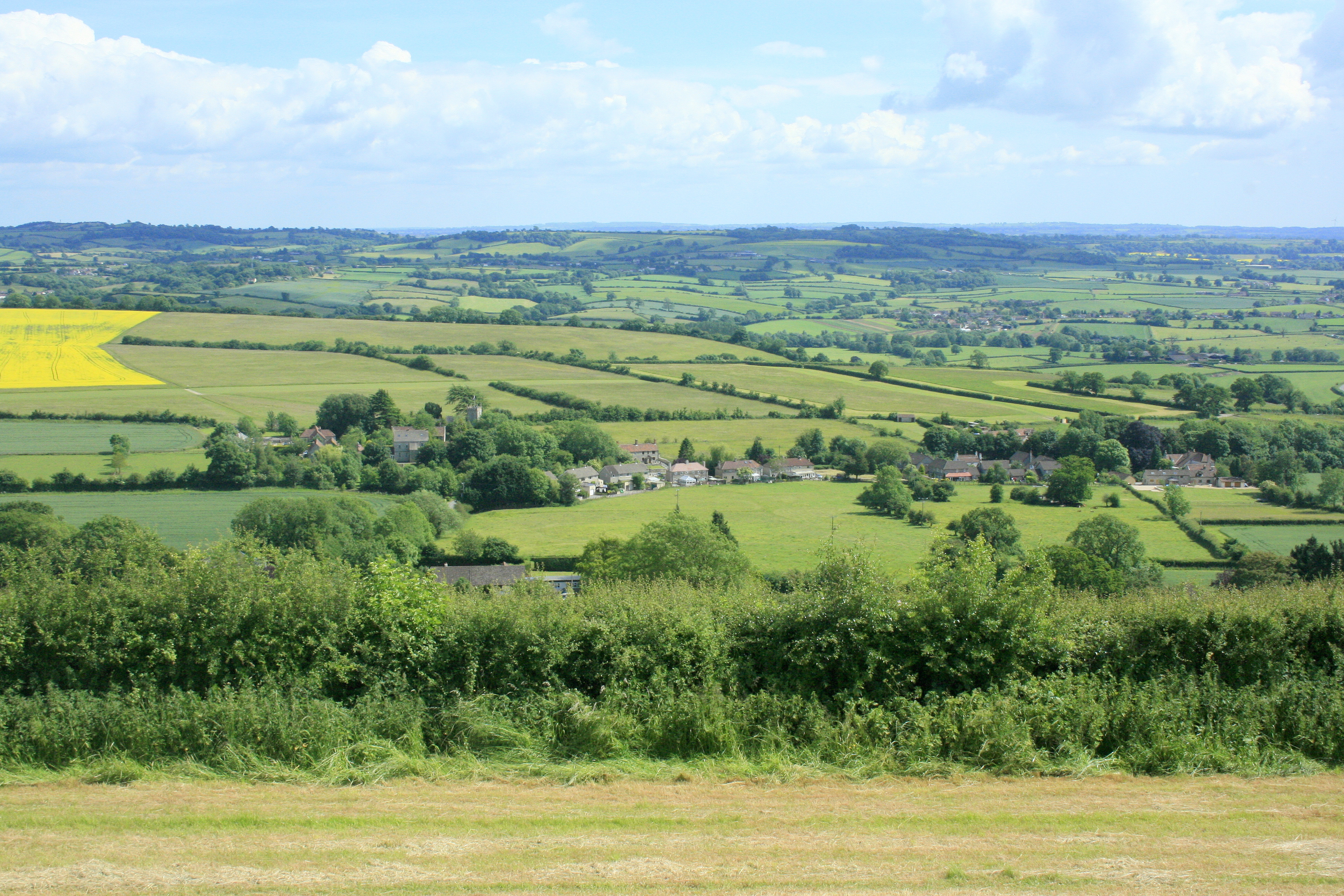
English: Norton Malreward from Maes Knoll. Turning right from 1383481 and facing almost due south, Norton Malreward appears, its parish church can be seen among the trees.
An interesting story is told in: http://www.themodernantiquarian.com/post/39162/maes_knoll.html "This [Maes Knoll] is where Hautville's Quoit was thrown from, by Sir John Haut(e)ville (you can read more about this on the Hautville's Quoit page). He was just rehearsing for a throwing match with the Devil, which he ended up winning by throwing a rock from Shute Shelve to Compton Bishop (about a mile and a half) - the Devil threw 3 furlongs shorter. (from Grinsell's folklore book I think). Sir John is apparently bured [sic] in Chew Magna church, where there's an oak effigy of him. This gentleman was remarkable for prodigious strength, as the Irish oak is probably intended to denote. Vulgar tradition informs us, that Edward the First having requested Sir John to shew him a specimen of his abilities, the knight undertook to convey three of the stoutest men in England to the top of Norton Tower [Norton Malreward is at the foot of Maes Knoll], situated in a neighbouring parish. Accordingly, taking one under each arm, and a third in his teeth, he proceeded on his task. The two in his arms, making some resistance, were squeezed to death, but the other was carried up without sustaining the smallest injury" |
| Tarih | |
| Kaynak | From geograph.org.uk |
| Yazar | Maurice Pullin |
| İzin (Bu dosyanın tekrar kullanımı) |
Creative Commons Attribution Share-alike license 2.0 |
| Kamera pozisyonu | | Bu ve diğer görüntülerin konumlarını şurada belirle: OpenStreetMap |
|---|
Lisanslama

|
Bu Coğrafya projesinden alınmış olan bir görüntüdür. Coğrafi internet sitesinde bulunan bu fotoğraf sayfasından fotoğrafçıya ait iletişim bilgilerine ulaşabilirsiniz. Bu görüntünün telif hakkı sahibi Maurice Pullin olup, yeniden kullanılması amacıyla Creative Commons Attribution-ShareAlike 2.0 lisansı ile lisanslandırılmıştır.
|
- Şu seçeneklerde özgürsünüz:
- paylaşım – eser paylaşımı, dağıtımı ve iletimi
- içeriği değiştirip uyarlama – eser adaptasyonu
- Aşağıdaki koşullar geçerli olacaktır:
- atıf – Esere yazar veya lisans sahibi tarafından belirtilen (ancak sizi ya da eseri kullanımınızı desteklediklerini ileri sürmeyecek bir) şekilde atıfta bulunmalısınız.
- benzer paylaşım – Maddeyi yeniden karıştırır, dönüştürür veya inşa ederseniz, katkılarınızı orijinal olarak aynı veya uyumlu lisans altında dağıtmanız gerekir.
Dosya geçmişi
Dosyanın herhangi bir zamandaki hâli için ilgili tarih/saat kısmına tıklayın.
| Tarih/Saat | Küçük resim | Boyutlar | Kullanıcı | Yorum | |
|---|---|---|---|---|---|
| güncel | 23.11, 8 Eylül 2017 | | 3.888 × 2.592 (6,14 MB) | Geograph Update Bot | Higher-resolution version from Geograph. |
| 09.42, 4 Ekim 2009 |  | 640 × 427 (150 KB) | Rodw | {{Information |Description=Norton Malreward from Maes Knoll |Source=From [http://www.geograph.org.uk/photo/1384392 geograph.org.uk] |Date=2009-06-16 |Author=[http://www.geograph.org.uk/profile/14368 Maurice Pullin] |Permission=Creative Commons Attribution |
Dosya kullanımı
Bu görüntü dosyasına bağlantısı olan sayfalar:
Küresel dosya kullanımı
Aşağıdaki diğer vikiler bu dosyayı kullanır:
- ceb.wikipedia.org üzerinde kullanımı
- en.wikipedia.org üzerinde kullanımı
- fr.wikipedia.org üzerinde kullanımı
- lld.wikipedia.org üzerinde kullanımı
- pl.wikipedia.org üzerinde kullanımı
- www.wikidata.org üzerinde kullanımı
- zh-min-nan.wikipedia.org üzerinde kullanımı