
Dosya:Map of Wind Cave National Park.png
Bu önizlemenin boyutu: 661 × 600 piksel. Diğer çözünürlükler: 265 × 240 piksel | 529 × 480 piksel | 846 × 768 piksel | 1.128 × 1.024 piksel | 2.486 × 2.256 piksel.
Tam çözünürlük ((2.486 × 2.256 piksel, dosya boyutu: 854 KB, MIME tipi: image/png))
Bu dosya Wikimedia Commons'ta bulunmaktadır. Dosyanın açıklaması aşağıda gösterilmiştir. Commons, serbest/özgür telifli medya dosyalarının bulundurulduğu depodur. Siz de yardım edebilirsiniz. |
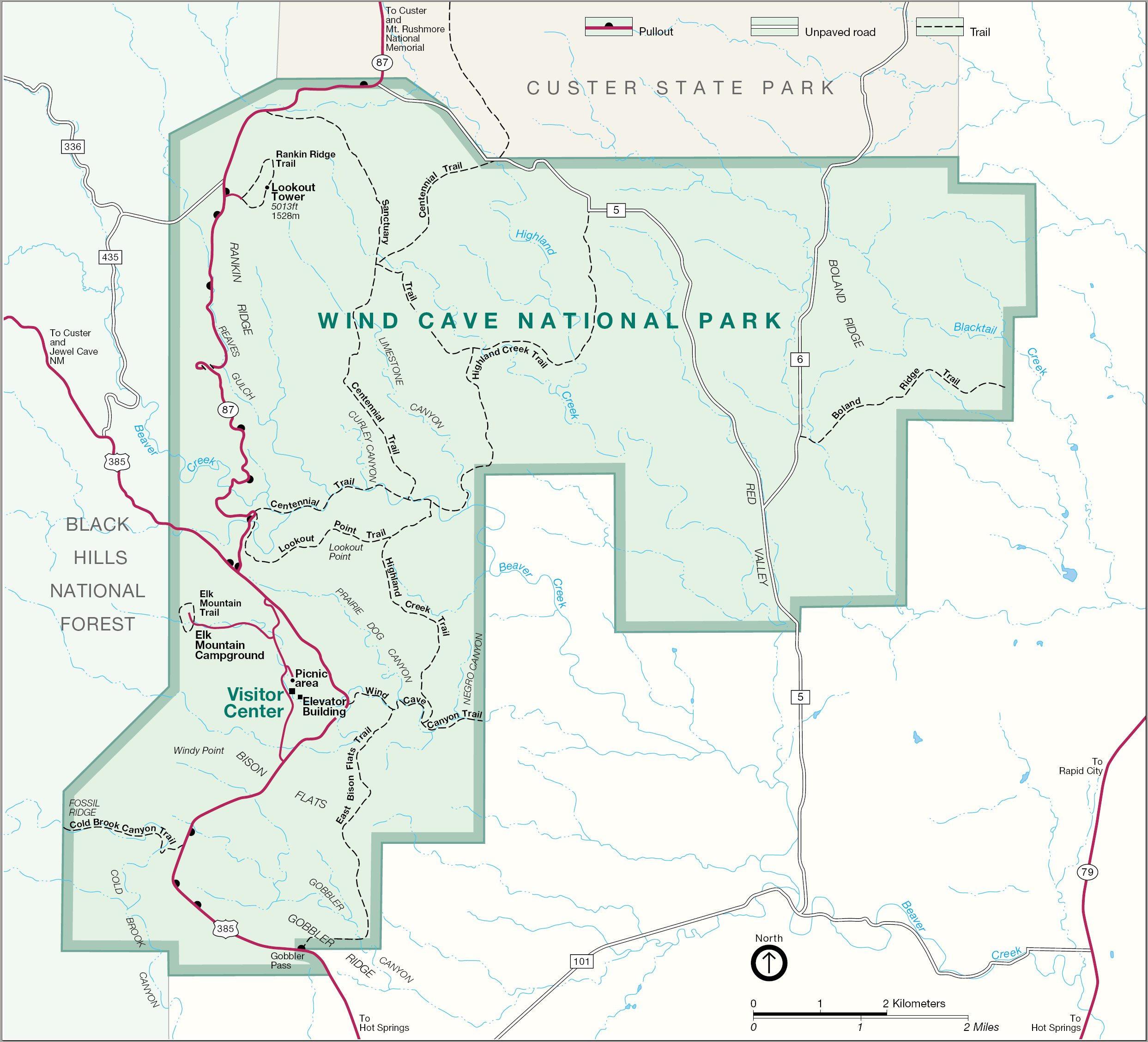
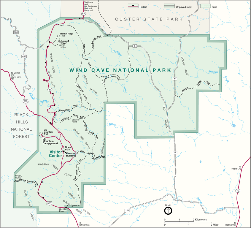
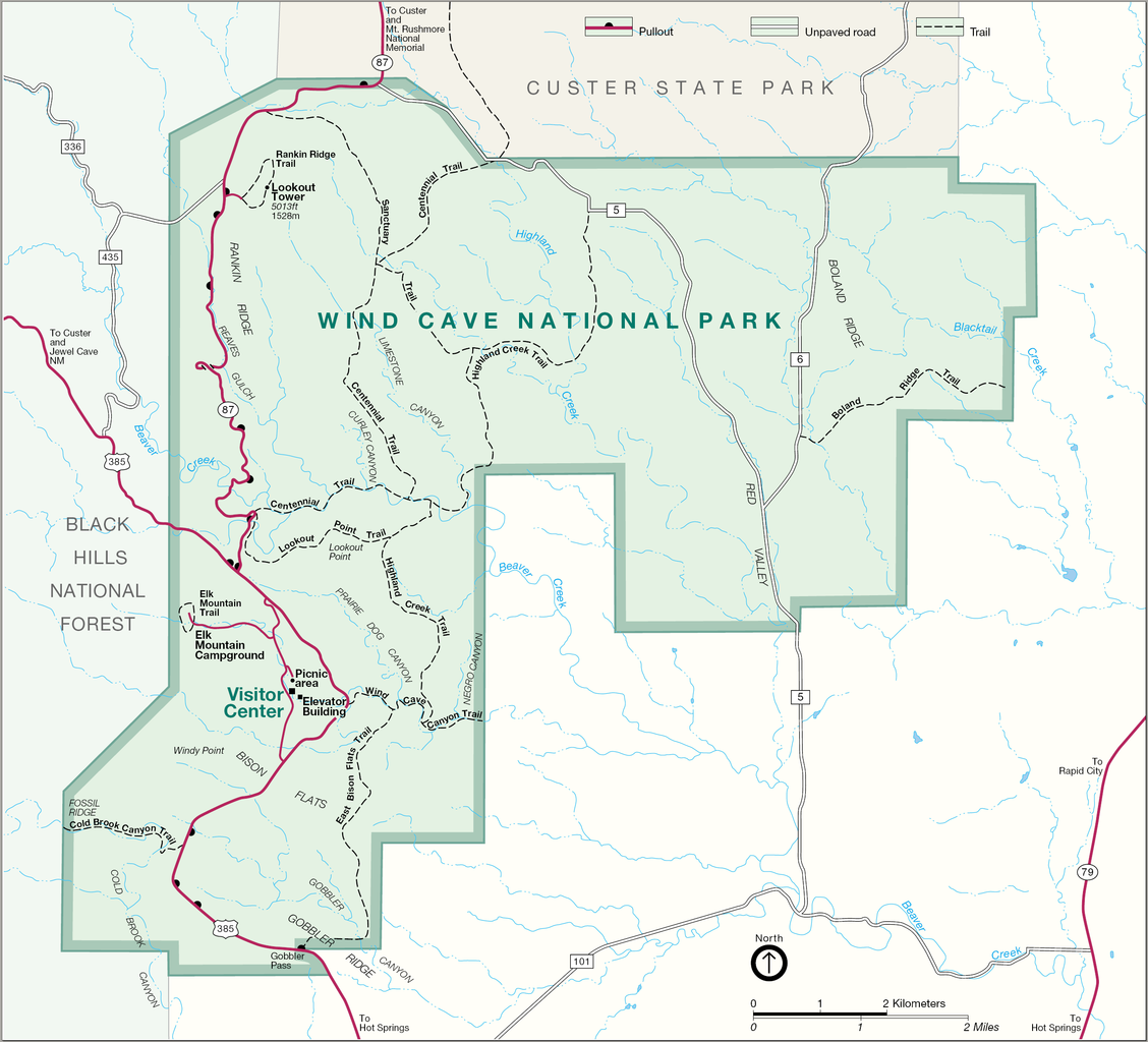
| Açıklama | Map of Wind Cave National Park — in South Dakota. |
| Kaynak | http://www.nps.gov |
| Yazar |
| This image or media file contains material based on a work of a National Park Service employee, created as part of that person's official duties. As a work of the U.S. federal government, such work is in the public domain in the United States. See the NPS website and NPS copyright policy for more information. |
Dosya geçmişi
Dosyanın herhangi bir zamandaki hâli için ilgili tarih/saat kısmına tıklayın.
| Tarih/Saat | Küçük resim | Boyutlar | Kullanıcı | Yorum | |
|---|---|---|---|---|---|
| güncel | 14.41, 19 Ağustos 2006 | | 2.486 × 2.256 (854 KB) | Huebi~commonswiki | {{Information |Description=Map of Wind Cave National Park |Source=http://www.nps.gov |Date= |Author= |Permission= |other_versions= }} {{PD-USGov-NPS}} category:Wind Cave National Park |
Dosya kullanımı
Bu görüntü dosyasına bağlantısı olan sayfalar:
Küresel dosya kullanımı
Aşağıdaki diğer vikiler bu dosyayı kullanır:
- da.wikipedia.org üzerinde kullanımı
- de.wikipedia.org üzerinde kullanımı
- es.wikipedia.org üzerinde kullanımı
- nl.wikipedia.org üzerinde kullanımı
- no.wikipedia.org üzerinde kullanımı
- pl.wikipedia.org üzerinde kullanımı
- ru.wikipedia.org üzerinde kullanımı