
Dosya:Bedford UK locator map.svg

Bu SVG dosyasının PNG önizlemesinin boyutu: 530 × 599 piksel. Diğer çözünürlükler: 212 × 240 piksel | 425 × 480 piksel | 679 × 768 piksel | 906 × 1.024 piksel | 1.812 × 2.048 piksel | 1.120 × 1.266 piksel.
Tam çözünürlük (SVG dosyası, sözde 1.120 × 1.266 piksel, dosya boyutu: 675 KB)
Bu dosya Wikimedia Commons'ta bulunmaktadır. Dosyanın açıklaması aşağıda gösterilmiştir. Commons, serbest/özgür telifli medya dosyalarının bulundurulduğu depodur. Siz de yardım edebilirsiniz. |
| Açıklama |
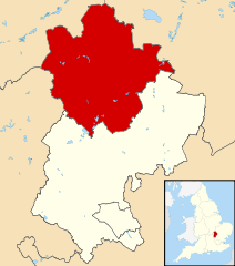
Map of Bedfordshire, UK with Bedford highlighted. Equirectangular map projection on WGS 84 datum, with N/S stretched 160% |
| Tarih | |
| Kaynak |
|
| Yazar | Nilfanion, created using Ordnance Survey data |
| İzin (Bu dosyanın tekrar kullanımı) |
Bu dosya, Creative Commons Atıf-Benzer Paylaşım 3.0 Taşınmamış lisansı ile lisanslanmıştır Atıf: Contains Ordnance Survey data © Crown copyright and database right
|
Dosya geçmişi
Dosyanın herhangi bir zamandaki hâli için ilgili tarih/saat kısmına tıklayın.
| Tarih/Saat | Küçük resim | Boyutlar | Kullanıcı | Yorum | |
|---|---|---|---|---|---|
| güncel | 22.42, 3 Ağustos 2011 | | 1.120 × 1.266 (675 KB) | Nilfanion | {{Information |Description=Map of Bedfordshire, UK with Bedford highlighted. Equirectangular map projection on WGS 84 datum, with N/S stretched 160% |Source=Ordnance Survey [https://www.ord |
Dosya kullanımı
Bu görüntü dosyasına bağlantısı olan sayfalar:
Küresel dosya kullanımı
Aşağıdaki diğer vikiler bu dosyayı kullanır:
- cy.wikipedia.org üzerinde kullanımı
- da.wikipedia.org üzerinde kullanımı
- en.wikipedia.org üzerinde kullanımı
- es.wikipedia.org üzerinde kullanımı
- fa.wikipedia.org üzerinde kullanımı
- fi.wikipedia.org üzerinde kullanımı
- frr.wikipedia.org üzerinde kullanımı
- fr.wikipedia.org üzerinde kullanımı
- Bedford (Royaume-Uni)
- Cardington (Bedfordshire)
- Kempston
- Wixams
- Bedford (district)
- Liste des paroisses civiles du Bedfordshire
- Carlton (Bedfordshire)
- Biddenham
- Modèle:Palette Bedford
- Oakley (Bedfordshire)
- Bletsoe
- Bolnhurst and Keysoe
- Colmworth
- Cople
- Wymington
- Staploe
- Stevington
- Stewartby
- Wootton (Bedfordshire)
- Willington (Bedfordshire)
- Wilden (Bedfordshire)
- Thurleigh
- Stagsden
- Sharnbrook
- Renhold
- Ravensden
- Podington
- Pertenhall
- Pavenham
- Odell (Bedfordshire)
- Milton Ernest
- Little Barford
- Little Staughton
- Harrold (Bedfordshire)
- Great Denham
- Great Barford
- Elstow
- Kempston Rural
- Knotting and Souldrop
- Dean and Shelton
- Wyboston, Chawston and Colesden
- Felmersham
- Chellington
Bu dosyanın daha fazla küresel kullanımını görüntüle.